
Mapa topográfico Estambul
Mapa interactivo
Haga clic en el mapa para ver la altitud.
Acerca de este mapa
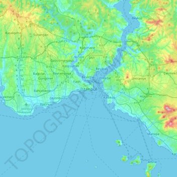
Nombre: Mapa topográfico Estambul, altitud, relieve.
Lugar: Estambul, Fatih, Estambul, Marmara Bölgesi, 34122, Turquía (40.84638 28.81587 41.16638 29.13587)
Altitud media: 57 m
Altitud mínima: -2 m
Altitud máxima: 429 m