
Mapa topográfico Nueva Orleans
Mapa interactivo
Haga clic en el mapa para ver la altitud.
Nueva Orleans
Nueva Orleans fue establecida originalmente en los diques naturales o tierras altas a lo largo del río. La altitud media de la ciudad es actualmente entre uno y dos pies bajo el nivel del mar, con algunas partes de la ciudad de hasta 6 m en las partes más altas y 2 m bajo el nivel del mar en los suburbios del este de Nueva Orleans.
Acerca de este mapa
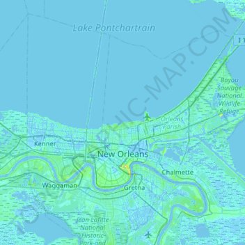
Nombre: Mapa topográfico Nueva Orleans, altitud, relieve.
Altitud media: 1 m
Altitud mínima: -6 m
Altitud máxima: 30 m