
Gracias por apoyar a este sitio ❤️
Haz una donación
Haz una donación
Mapa topográfico Cuyo
Haga clic en el mapa para ver la altitud.
Gracias por apoyar a este sitio ❤️
Haz una donación
Haz una donación
Acerca de este mapa
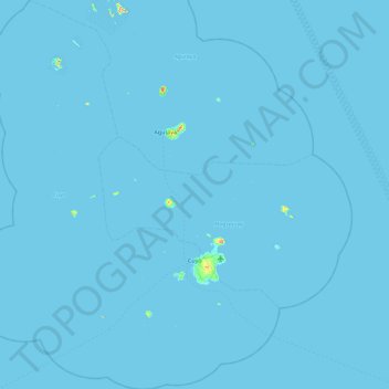
Nombre: Mapa topográfico Cuyo, altitud, relieve.
Lugar: Cuyo, Palawan, Mimaropa, 5318, Filipinas (10.55793 120.47158 11.45374 121.20733)
Altitud media: 0 m
Altitud mínima: -1 m
Altitud máxima: 246 m
Gracias por apoyar a este sitio ❤️
Haz una donación
Haz una donación
Otros mapas topográficos
Haga clic en un mapa para ver su topografía, su altitud y su relieve.