
Mapa topográfico Alderley Edge
Mapa interactivo
Haga clic en el mapa para ver la altitud.
Acerca de este mapa
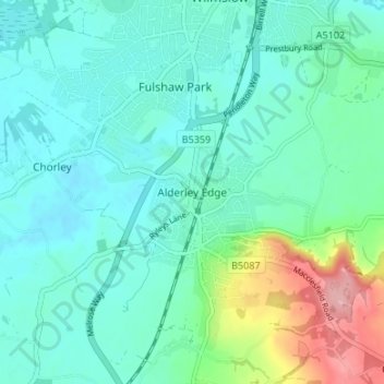
Nombre: Mapa topográfico Alderley Edge, altitud, relieve.
Altitud media: 92 m
Altitud mínima: 63 m
Altitud máxima: 196 m
Alderley Edge is 6 miles (10 km) northwest of Macclesfield and 15 miles (24 km) south of Manchester, at the base of a steep and thickly wooded sandstone escarpment, Alderley Edge, which is the area's chief topographical feature and overlooks the Cheshire Plain.