
Mapa topográfico Wrightwood
Mapa interactivo
Haga clic en el mapa para ver la altitud.
Wrightwood
Wrightwood is a census-designated place in San Bernardino County, California. It sits at an elevation of 5,935 feet (1,809 m). The population was 4,525 at the 2010 census, up from the population of 3,837 at the 2000 census. Wrightwood is located 77 miles northeast of Los Angeles.
Acerca de este mapa
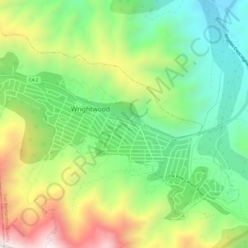
Nombre: Mapa topográfico Wrightwood, altitud, relieve.
Altitud media: 1,904 m
Altitud mínima: 1,549 m
Altitud máxima: 2,474 m