
Mapa topográfico Udhampur
Mapa interactivo
Haga clic en el mapa para ver la altitud.
Udhampur
The district of Udhampur is located in the Shivalik range of Himalayas and the terrain is mostly mountainous. The upper reaches of the district experience snowfall in the winter season. The city itself is in a relatively flatter part of the district at an elevation of 756 metres (2480 feet) and it rarely experiences any snowfall.
Acerca de este mapa
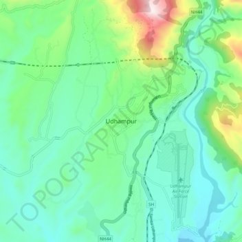
Nombre: Mapa topográfico Udhampur, altitud, relieve.
Lugar: Udhampur, Jammu and Kashmir, 182101, India (32.76197 74.97315 33.08197 75.29315)
Altitud media: 1,078 m
Altitud mínima: 333 m
Altitud máxima: 2,672 m