
Mapa topográfico Range Island
Mapa interactivo
Haga clic en el mapa para ver la altitud.
Acerca de este mapa
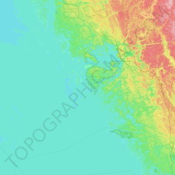
Nombre: Mapa topográfico Range Island, altitud, relieve.
Altitud media: 196 m
Altitud mínima: 171 m
Altitud máxima: 315 m
Otros mapas topográficos
Haga clic en un mapa para ver su topografía, su altitud y su relieve.
Mayne Island
Canada > Ontario > The Archipelago
Mayne Island, The Archipelago, Parry Sound District, Ontario, Canada
Altitud media: 194 m
Algonquin Island
Canada > Ontario > The Archipelago
Algonquin Island, The Archipelago, Parry Sound District, Ontario, Canada
Altitud media: 200 m
Masson Island
Canada > Ontario > The Archipelago
Masson Island, The Archipelago, Parry Sound District, Ontario, Canada
Altitud media: 196 m
Traves Lake
Canada > Ontario > The Archipelago
Traves Lake, Aga Ming Road, The Archipelago, Parry Sound District, Ontario, P2A 2W8, Canada
Altitud media: 220 m