
Mapa topográfico Rawcliffe
Mapa interactivo
Haga clic en el mapa para ver la altitud.
Acerca de este mapa
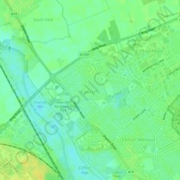
Nombre: Mapa topográfico Rawcliffe, altitud, relieve.
Altitud media: 14 m
Altitud mínima: 4 m
Altitud máxima: 25 m
Otros mapas topográficos
Haga clic en un mapa para ver su topografía, su altitud y su relieve.
Airedale
United Kingdom > England > York
Airedale, Wentworth Way, Heslington, York, Yorkshire and the Humber, England, YO10 5NG, United Kingdom
Altitud media: 136 m
Hogg's Pond
United Kingdom > England > York
Hogg's Pond, Chaloners Road, Woodthorpe, York, Yorkshire and the Humber, England, YO24 2TW, United Kingdom
Altitud media: 14 m
Stock Hill
United Kingdom > England > York
Stock Hill, York, Yorkshire and the Humber, England, YO23 3PW, United Kingdom
Altitud media: 28 m