
Mapa topográfico Aluva
Mapa interactivo
Haga clic en el mapa para ver la altitud.
Acerca de este mapa
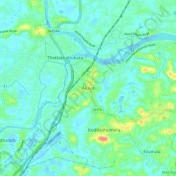
Nombre: Mapa topográfico Aluva, altitud, relieve.
Lugar: Aluva, Ernakulam district, Kerala, 683101, India (10.06041 76.31699 10.14041 76.39699)
Altitud media: 11 m
Altitud mínima: -2 m
Altitud máxima: 52 m
There are two railway stations in Aluva: Aluva Railway Station anmd Chowwara Railway Station. Aluva Railway Station is a major stop for trains that passes north to south of Kerala. It is the second busiest station in Kerala by number of trains, second only to Thrissur. The station is important for southern railway because of the number of passengers itself. The commuters and travellers from Idukki district have to use either this station or the Tripunithura railway station for all their train journeys as there is no possible railway in the Idukki topography. There are no trains starting or ending at this station, but there are a lot of trains which stop for considerable duration here.