
Mapa topográfico Roaring Gap
Mapa interactivo
Haga clic en el mapa para ver la altitud.
Acerca de este mapa
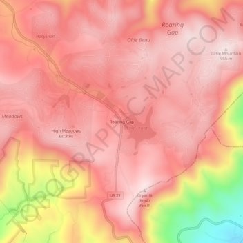
Nombre: Mapa topográfico Roaring Gap, altitud, relieve.
Altitud media: 840 m
Altitud mínima: 492 m
Altitud máxima: 962 m
Otros mapas topográficos
Haga clic en un mapa para ver su topografía, su altitud y su relieve.
Piney Creek
United States > North Carolina > Alleghany County
Piney Creek, Alleghany County, North Carolina, 28663, United States
Altitud media: 839 m
Laurel Springs
United States > North Carolina > Alleghany County
Laurel Springs, Alleghany County, North Carolina, 28644, United States
Altitud media: 893 m
Sparta
United States > North Carolina > Alleghany County
Sparta, Alleghany County, North Carolina, 28675, United States
Altitud media: 893 m