
Mapa topográfico State Center
Mapa interactivo
Haga clic en el mapa para ver la altitud.
Acerca de este mapa
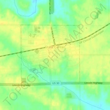
Nombre: Mapa topográfico State Center, altitud, relieve.
Lugar: State Center, Marshall County, Iowa, United States (42.00734 -93.17500 42.02215 -93.15552)
Altitud media: 322 m
Altitud mínima: 308 m
Altitud máxima: 331 m
Otros mapas topográficos
Haga clic en un mapa para ver su topografía, su altitud y su relieve.
Marshalltown
United States > Iowa > Marshall County
Marshalltown, Marshall County, Iowa, 50158, United States
Altitud media: 283 m
Saint Anthony
United States > Iowa > Marshall County > St. Anthony > Saint Anthony
Saint Anthony, St. Anthony, Marshall County, Iowa, 50239, United States
Altitud media: 317 m
Albion
United States > Iowa > Marshall County > Albion
Albion, Marshall County, Iowa, United States
Altitud media: 285 m