
Mapa topográfico Addison (Webster Springs)
Mapa interactivo
Haga clic en el mapa para ver la altitud.
Addison (Webster Springs)
Webster Springs is located at 38°28′34″N 80°24′36″W / 38.47611°N 80.41000°W / 38.47611; -80.41000 (38.476192, -80.410025), along the Elk River. According to the United States Census Bureau, the town has a total area of 0.47 square miles (1.22 km2), of which 0.45 square miles (1.17 km2) is land and 0.02 square miles (0.05 km2) is water. It lies at an elevation of 1,460 ft. (445m) and is close to Buffalo Bull Knob, elevation 2,799 ft.
Acerca de este mapa
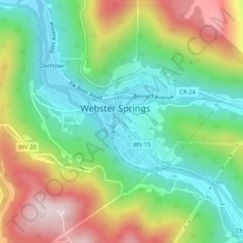
Nombre: Mapa topográfico Addison (Webster Springs), altitud, relieve.
Altitud media: 600 m
Altitud mínima: 431 m
Altitud máxima: 878 m
Otros mapas topográficos
Haga clic en un mapa para ver su topografía, su altitud y su relieve.