
Mapa topográfico Linge
Mapa interactivo
Haga clic en el mapa para ver la altitud.
Acerca de este mapa
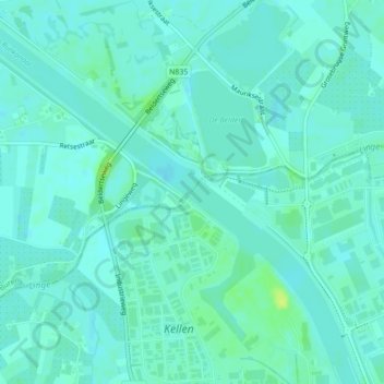
Nombre: Mapa topográfico Linge, altitud, relieve.
Lugar: Linge, Tiel, Gelderland, Nederland, 4011LX, Nederland (51.91872 5.43332 51.92041 5.43569)
Altitud media: 5 m
Altitud mínima: 1 m
Altitud máxima: 17 m
Otros mapas topográficos
Haga clic en un mapa para ver su topografía, su altitud y su relieve.
Kerk Avezaath
Nederland > Gelderland > Tiel
Kerk Avezaath, Tiel, Gelderland, Nederland
Altitud media: 6 m
Dode Linge
Nederland > Gelderland > Tiel
Dode Linge, Rivierenlandlaan, Westroijen, Tiel, Gelderland, Nederland, 4003JK, Nederland
Altitud media: 6 m
Kapel Avezaath
Nederland > Gelderland > Tiel
Kapel Avezaath, Tiel, Gelderland, Nederland
Altitud media: 5 m
Zennewijnen
Nederland > Gelderland > Tiel > Zennewijnen
Zennewijnen, Tiel, Gelderland, Nederland
Altitud media: 6 m