
Mapa topográfico Bardhaman
Haga clic en el mapa para ver la altitud.
Bardhaman
The region has an average elevation of 40 metres (131 ft). The city is situated 1100 km from New Delhi and a little less than 100 km north-west of Kolkata on the Grand Trunk Road (National Highway 19) and Eastern Railway. The chief rivers are the Damodar and the Banka.
Acerca de este mapa
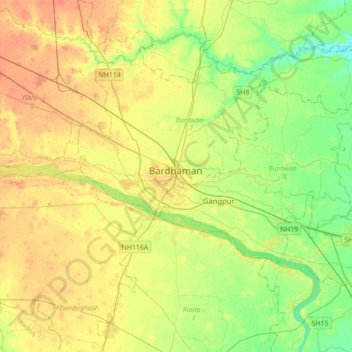
Nombre: Mapa topográfico Bardhaman, altitud, relieve.
Altitud media: 30 m
Altitud mínima: 14 m
Altitud máxima: 45 m