
Mapa topográfico Gotha
Mapa interactivo
Haga clic en el mapa para ver la altitud.
Acerca de este mapa
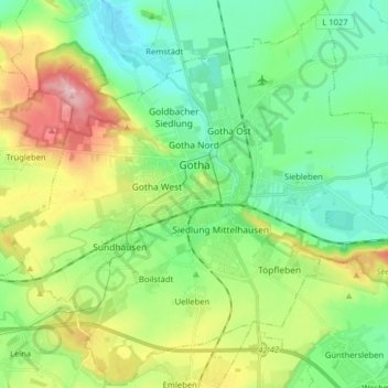
Nombre: Mapa topográfico Gotha, altitud, relieve.
Lugar: Gotha, Landkreis Gotha, Thüringen, Duitsland (50.89218 10.62230 50.99128 10.78184)
Altitud media: 320 m
Altitud mínima: 263 m
Altitud máxima: 442 m
Otros mapas topográficos
Haga clic en un mapa para ver su topografía, su altitud y su relieve.
Tambach-Dietharz
Duitsland > Thüringen > Landkreis Gotha
Tambach-Dietharz, Landkreis Gotha, Thüringen, 99897, Duitsland
Altitud media: 663 m
Friedrichroda
Duitsland > Thüringen > Landkreis Gotha
Friedrichroda, Landkreis Gotha, Thüringen, 99894, Duitsland
Altitud media: 495 m