

Mapa topográfico Wildflecken
Haga clic en el mapa para ver la altitud.
Wildflecken
Dubbed "The Top of the Rock" by American troops, the small post was among the most feared and disliked of all training areas due to high altitude and extreme weather conditions. It featured ranges for tanks, artillery and basic training facilities. Additionally, it was one of only a few training sites allowed by the German government to utilize CS gas in training.
Acerca de este mapa
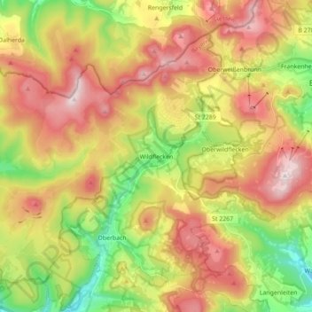
Nombre: Mapa topográfico Wildflecken, altitud, relieve.
Lugar: Wildflecken, Landkreis Bad Kissingen, Bavaria, 97772, Germany (50.33132 9.78223 50.42253 9.95592)
Altitud media: 607 m
Altitud mínima: 369 m
Altitud máxima: 931 m
Otros mapas topográficos
Haga clic en un mapa para ver su topografía, su altitud y su relieve.


Bad Kissingen
Germany > Bavaria > Landkreis Bad Kissingen > Bad Kissingen > Bad Kissingen
Altitud media: 295 m