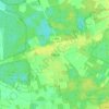
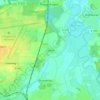
Mapa topográfico Garbsen
Haga clic en el mapa para ver la altitud.
Garbsen
Garbsen belongs to the Weser-Aller-Flachland natural area and is situated between the lowlands of the river Leine and the Otternhagener Moor. The differences in altitude are only a few metres.
Acerca de este mapa

Nombre: Mapa topográfico Garbsen, altitud, relieve.
Lugar: Garbsen, Region Hannover, Lower Saxony, Germany (52.39799 9.48440 52.50121 9.64537)
Altitud media: 50 m
Altitud mínima: 39 m
Altitud máxima: 64 m
Otros mapas topográficos
Haga clic en un mapa para ver su topografía, su altitud y su relieve.