Mapa topográfico Chandigarh
Haga clic en el mapa para ver la altitud.
Chandigarh
Chandigarh is located by the foothills of the Shivalik Range of the Himalayas in northwest India. It covers an area of approximately 114 km2. It borders the states of Punjab and Haryana. The exact geographic coordinates of Chandigarh are 30°44′N 76°47′E / 30.74°N 76.79°E / 30.74; 76.79. It has an average elevation of 321 metres (1053 ft).
Acerca de este mapa
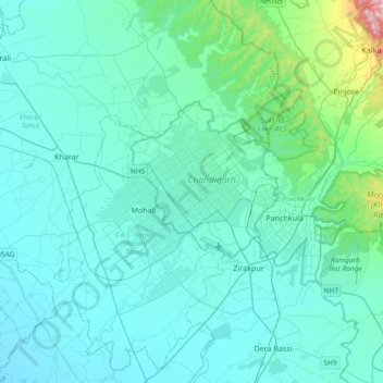
Nombre: Mapa topográfico Chandigarh, altitud, relieve.
Lugar: Chandigarh, 160018, India (30.57344 76.61971 30.89344 76.93971)
Altitud media: 378 m
Altitud mínima: 276 m
Altitud máxima: 1,651 m
Otros mapas topográficos
Haga clic en un mapa para ver su topografía, su altitud y su relieve.