
Mapa topográfico Panaji
Mapa interactivo
Haga clic en el mapa para ver la altitud.
Panaji
Panaji was annexed by India with the rest of Goa and the former Portuguese territories after the Indian annexation of Portuguese India in 1961. It became a state-capital on Goa's elevation to statehood in 1987. Between 1961 and 1987, it was the capital of the Union Territory of Goa, Daman and Diu. A new Legislative Assembly complex was inaugurated in March 2000, across the Mandovi River, in Alto Porvorim. Panaji is also the administrative headquarters of North Goa district.
Acerca de este mapa
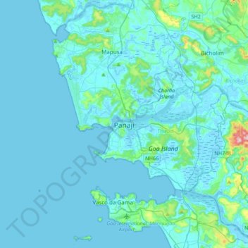
Nombre: Mapa topográfico Panaji, altitud, relieve.
Lugar: Panaji, Tiswadi, North Goa, Goa, 403001, India (15.33899 73.66821 15.65899 73.98821)
Altitud media: 19 m
Altitud mínima: -3 m
Altitud máxima: 285 m
Otros mapas topográficos
Haga clic en un mapa para ver su topografía, su altitud y su relieve.