
Mapa topográfico Oldtown
Mapa interactivo
Haga clic en el mapa para ver la altitud.
Acerca de este mapa
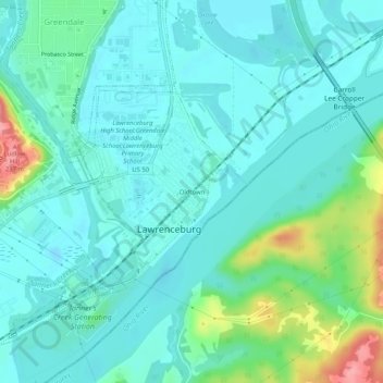
Nombre: Mapa topográfico Oldtown, altitud, relieve.
Altitud media: 156 m
Altitud mínima: 134 m
Altitud máxima: 239 m
Otros mapas topográficos
Haga clic en un mapa para ver su topografía, su altitud y su relieve.
Upland
United States > Indiana > Dearborn County > Lawrenceburg
Upland, Lawrenceburg, Lawrenceburg Township, Dearborn County, Indiana, 47025, United States
Altitud media: 219 m