
Mapa topográfico Mithatpaşa Mahallesi
Mapa interactivo
Haga clic en el mapa para ver la altitud.
Acerca de este mapa
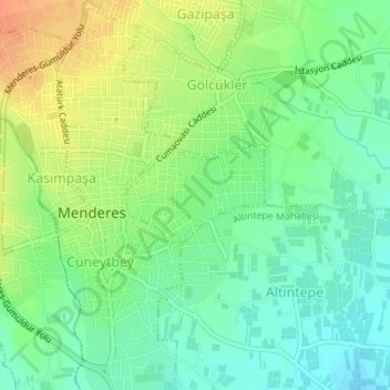
Nombre: Mapa topográfico Mithatpaşa Mahallesi, altitud, relieve.
Lugar: Mithatpaşa Mahallesi, Menderes, Izmir, Aegean Region, Turkey (38.24934 27.13588 38.25634 27.14842)
Altitud media: 110 m
Altitud mínima: 92 m
Altitud máxima: 136 m
Otros mapas topográficos
Haga clic en un mapa para ver su topografía, su altitud y su relieve.
Oğlananası
Turkey > Menderes > Oğlananası
Oğlananası, Menderes, Izmir, Aegean Region, 35470, Turkey
Altitud media: 137 m