
Mapa topográfico Oakhurst
Mapa interactivo
Haga clic en el mapa para ver la altitud.
Acerca de este mapa
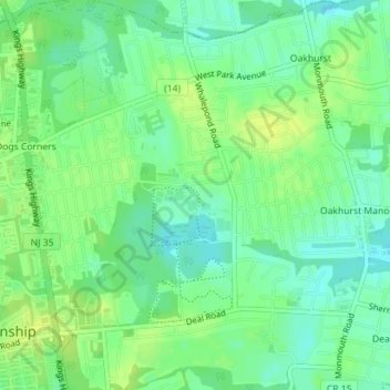
Nombre: Mapa topográfico Oakhurst, altitud, relieve.
Altitud media: 15 m
Altitud mínima: 6 m
Altitud máxima: 23 m
According to the United States Census Bureau, the CDP had a total area of 1.614 square miles (4.178 km2), including 1.611 square miles (4.171 km2) of land and 0.003 square miles (0.006 km2) of water (0.16%). The CDP also has an elevation of 46 feet above sea level.