
Gracias por apoyar a este sitio ❤️
Haz una donación
Haz una donación
Mapa topográfico Gomoh
Haga clic en el mapa para ver la altitud.
Gracias por apoyar a este sitio ❤️
Haz una donación
Haz una donación
Gomoh
Gomoh is located at 23°52′N 86°10′E / 23.87°N 86.17°E / 23.87; 86.17. It has an average elevation of 245 metres (803 feet). The town has an area of 8.96 km2. It is 37 km from the district administrative headquarters in Dhanbad.
Gracias por apoyar a este sitio ❤️
Haz una donación
Haz una donación
Acerca de este mapa
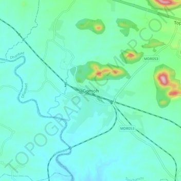
Nombre: Mapa topográfico Gomoh, altitud, relieve.
Lugar: Gomoh, Topchanchi, Dhanbad, Jharkhand, 828401, India (23.83353 86.11159 23.91353 86.19159)
Altitud media: 248 m
Altitud mínima: 202 m
Altitud máxima: 487 m
Gracias por apoyar a este sitio ❤️
Haz una donación
Haz una donación