
Mapa topográfico Mount Dulang-Dulang
Mapa interactivo
Haga clic en el mapa para ver la altitud.
Acerca de este mapa
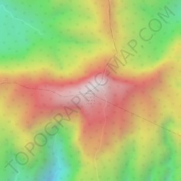
Nombre: Mapa topográfico Mount Dulang-Dulang, altitud, relieve.
Altitud media: 2,448 m
Altitud mínima: 1,925 m
Altitud máxima: 2,896 m
Mount Dulang-dulang, dubbed by Filipino mountaineers as "D2" and also known as Mount Katanglad, is the highest elevation peak in the Kitanglad Mountain Range, located in the north central portion of the province of Bukidnon in the island of Mindanao. It is the second highest mountain of the Philippines at 2,941 metres (9,649 ft) above sea level, second only to Mount Apo of Davao at 2,956 m (9,698 ft) and slightly higher than Mount Pulag of Luzon, the third highest at 2,928 m (9,606 ft).