
Mapa topográfico Bernbeuren
Mapa interactivo
Haga clic en el mapa para ver la altitud.
Acerca de este mapa
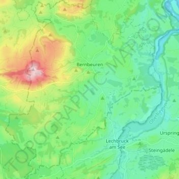
Nombre: Mapa topográfico Bernbeuren, altitud, relieve.
Altitud media: 789 m
Altitud mínima: 694 m
Altitud máxima: 1,047 m
Otros mapas topográficos
Haga clic en un mapa para ver su topografía, su altitud y su relieve.
Fischen
Deutschland > Bayern > Landkreis Weilheim-Schongau
Fischen, Pähl, Landkreis Weilheim-Schongau, Bayern, 82396, Deutschland
Altitud media: 577 m