
Mapa topográfico Bhowali
Haga clic en el mapa para ver la altitud.
Bhowali
Bhowali (Kumaoni: Bhoāli) is a town and a municipal board in Nainital District in the state of Uttarakhand, India. It is situated at a distance of 11 km (6.8 mi) from the city of Nainital, the district headquarters; at an average elevation of 1,654 m (5,427 ft) from sea level. It is the seat of Bhowali tehsil, one of the eight subdivisions of Nainital district.
Acerca de este mapa
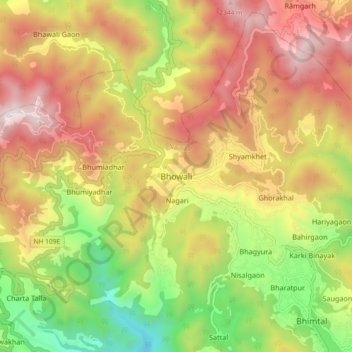
Nombre: Mapa topográfico Bhowali, altitud, relieve.
Lugar: Bhowali, Nainital, Nainital District, Uttarakhand, India (29.34350 79.47884 29.42350 79.55884)
Altitud media: 1,672 m
Altitud mínima: 866 m
Altitud máxima: 2,449 m