
Mapa topográfico Berghäuser
Mapa interactivo
Haga clic en el mapa para ver la altitud.
Acerca de este mapa
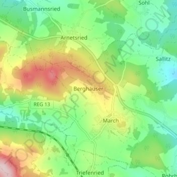
Nombre: Mapa topográfico Berghäuser, altitud, relieve.
Lugar: Berghäuser, Regen, Landkreis Regen, Bayern, Deutschland (48.96426 13.04032 49.00426 13.08032)
Altitud media: 635 m
Altitud mínima: 528 m
Altitud máxima: 824 m