
Mapa topográfico Cawayan
Mapa interactivo
Haga clic en el mapa para ver la altitud.
Cawayan
The locals of Cawayan still largely depend on subsistence farming despite its topographic advantage to adapt commercial farming. The lack of funding for agriculture and infrastructure and its political insecurity due to the presence and activities of armed groups kept by political families[19] and other subversive elements hinder the town's progress in spite of its geographical benefits.
Acerca de este mapa
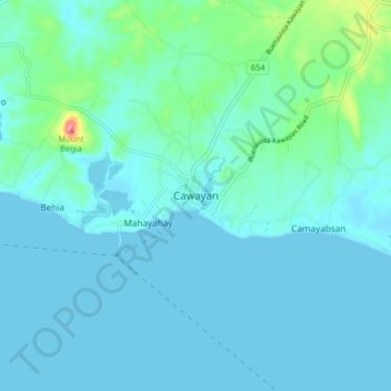
Nombre: Mapa topográfico Cawayan, altitud, relieve.
Lugar: Cawayan, Masbate, Bicol Region, 5409, Philippines (11.89013 123.72923 11.97013 123.80923)
Altitud media: 12 m
Altitud mínima: -1 m
Altitud máxima: 97 m