
Mapa topográfico Waterbury Lake
Mapa interactivo
Haga clic en el mapa para ver la altitud.
Acerca de este mapa
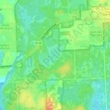
Nombre: Mapa topográfico Waterbury Lake, altitud, relieve.
Altitud media: 308 m
Altitud mínima: 292 m
Altitud máxima: 331 m
Otros mapas topográficos
Haga clic en un mapa para ver su topografía, su altitud y su relieve.
Seven Harbors
United States > Michigan > Oakland County > Highland Charter Township
Seven Harbors, Highland Charter Township, Oakland County, Michigan, 48356, United States
Altitud media: 314 m
Hickory Ridge
United States > Michigan > Oakland County > Highland Charter Township
Hickory Ridge, Highland Charter Township, Oakland County, Michigan, 48357, United States
Altitud media: 326 m
Veterans Park
United States > Michigan > Oakland County > Highland Charter Township
Veterans Park, Highland Charter Township, Oakland County, Michigan, 48357, United States
Altitud media: 310 m