
Mapa topográfico Lincoln
Mapa interactivo
Haga clic en el mapa para ver la altitud.
Acerca de este mapa
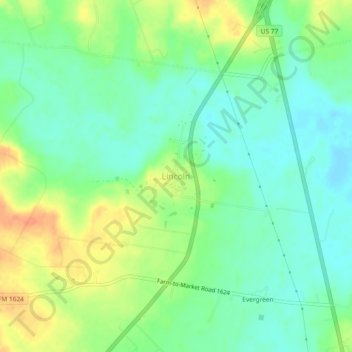
Nombre: Mapa topográfico Lincoln, altitud, relieve.
Lugar: Lincoln, Lee County, Texas, 78948, United States (30.26374 -96.98410 30.30374 -96.94410)
Altitud media: 117 m
Altitud mínima: 101 m
Altitud máxima: 141 m
Lincoln is an unincorporated community in central Lee County, Texas, United States. It lies along Highway 21 north of the city of Giddings, the county seat of Lee County. Its elevation is 371 feet (113 m). Although Lincoln is unincorporated, it has a post office, with the ZIP code of 78948.
Otros mapas topográficos
Haga clic en un mapa para ver su topografía, su altitud y su relieve.
Dime Box
United States > Texas > Lee County > Dime Box
Dime Box, Lee County, Texas, 77853, United States
Altitud media: 111 m
Giddings
United States > Texas > Lee County
Giddings, Lee County, Texas, 78942, United States
Altitud media: 141 m