
Gracias por apoyar a este sitio ❤️
Haz una donación
Haz una donación
Mapa topográfico Highlands
Haga clic en el mapa para ver la altitud.
Gracias por apoyar a este sitio ❤️
Haz una donación
Haz una donación
Highlands
Highlands was founded in 1875 after its two founders, Samuel Truman Kelsey and Clinton Carter Hutchinson, drew lines from Chicago to Savannah and from New Orleans to New York City. They felt that the place where these lines met would eventually become a great trading center and commercial crossroads. Highlands was named for its lofty elevation.
Gracias por apoyar a este sitio ❤️
Haz una donación
Haz una donación
Acerca de este mapa
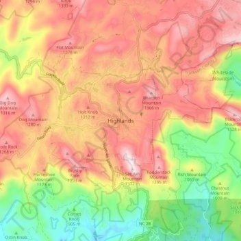
Nombre: Mapa topográfico Highlands, altitud, relieve.
Altitud media: 1,090 m
Altitud mínima: 767 m
Altitud máxima: 1,360 m
Gracias por apoyar a este sitio ❤️
Haz una donación
Haz una donación