
Mapa topográfico Kelseyville
Mapa interactivo
Haga clic en el mapa para ver la altitud.
Acerca de este mapa
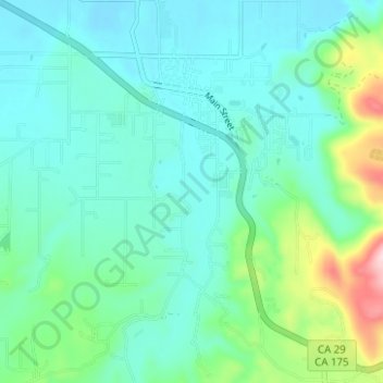
Nombre: Mapa topográfico Kelseyville, altitud, relieve.
Altitud media: 462 m
Altitud mínima: 409 m
Altitud máxima: 668 m
Kelseyville is a census-designated place (CDP) in Lake County, California, United States. Kelseyville is located 6 miles (9.7 km) southeast of Lakeport, at an elevation of 1,384 feet (422 m). The population was 3,353 at the 2010 census, up from 2,928 at the 2000 census.