
Mapa topográfico Mariposa
Mapa interactivo
Haga clic en el mapa para ver la altitud.
Acerca de este mapa
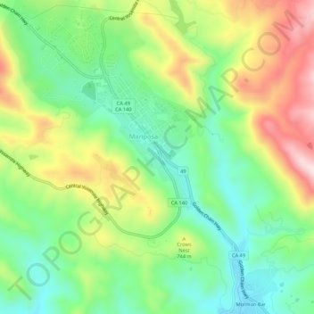
Nombre: Mapa topográfico Mariposa, altitud, relieve.
Altitud media: 686 m
Altitud mínima: 537 m
Altitud máxima: 917 m
Mariposa is located at 37°29′06″N 119°57′59″W / 37.48500°N 119.96639°W / 37.48500; -119.96639, at 1,949 feet (594 m) in elevation. It lies in the rugged foothills of the Sierra Nevada. Mariposa Creek flows through the town. Soils in the urban area are mostly brown to reddish brown loam of the Blasingame series. A gravelly loam is mapped as the Boomer series. These soils support thick grassland plus trees such as blue oak, black oak, gray pine, and ponderosa pine. To the west-northwest of town is a large area of sparse vegetation and rockland on which is found serpentine soil of the Henneke series.