
Gracias por apoyar a este sitio ❤️
Haz una donación
Haz una donación
Mapa topográfico Dunstable Downs
Haga clic en el mapa para ver la altitud.
Gracias por apoyar a este sitio ❤️
Haz una donación
Haz una donación
Dunstable Downs
Because of its elevation, Dunstable Downs hosted a station in the shutter telegraph chain which connected the Admiralty in London to its naval ships in the port of Great Yarmouth during the years 1808 to 1814.
Gracias por apoyar a este sitio ❤️
Haz una donación
Haz una donación
Acerca de este mapa
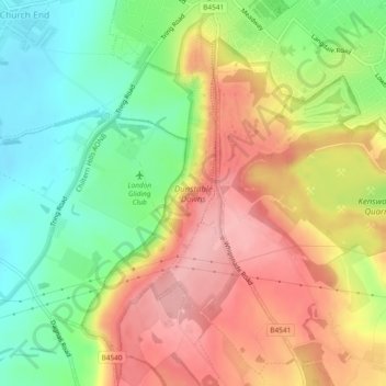
Nombre: Mapa topográfico Dunstable Downs, altitud, relieve.
Altitud media: 178 m
Altitud mínima: 112 m
Altitud máxima: 245 m
Gracias por apoyar a este sitio ❤️
Haz una donación
Haz una donación