
Mapa topográfico Malaspina Glacier
Mapa interactivo
Haga clic en el mapa para ver la altitud.
Acerca de este mapa
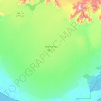
Nombre: Mapa topográfico Malaspina Glacier, altitud, relieve.
Lugar: Malaspina Glacier, Yakutat, Alaska, United States (59.74222 -140.95854 60.13048 -140.14049)
Altitud media: 393 m
Altitud mínima: -3 m
Altitud máxima: 2,086 m
The Malaspina is up to 600 meters (2,000 ft) thick in places, with the elevation of its bottom being estimated to be as much as 300 m (980 ft) below sea level.[4] There are two lakes on its margins: Oily Lake to the northwest, at the foot of the Samovar Hills between the Agassiz and Seward glaciers, and Malaspina Lake to the southeast, close to Yakutat Bay.
Otros mapas topográficos
Haga clic en un mapa para ver su topografía, su altitud y su relieve.
Mount Saint Elias
United States > Alaska > Yakutat
Mount Saint Elias, Yakutat, Alaska, United States
Altitud media: 4,672 m