
Haz una donación
Mapa topográfico Beaver Creek
Haga clic en el mapa para ver la altitud.
Haz una donación
Beaver Creek
Like most of Yukon, Beaver Creek has a subarctic climate (Dfc), and NRC Plant Hardiness Zone of 0a. It is situated at an elevation of approximately 650 m (2,130 ft). Beaver Creek experiences annual temperature average daily highs of 20 °C (68 °F) in July and average daily lows of −30 °C (−22 °F) in January. Record high temperature was 32.8 °C (91.0 °F) on June 15, 1969, and the lowest was −55.0 °C (−67.0 °F) on January 17, 1971. Beaver Creek has an average annual snowfall of 117.9 cm (46.42 in) and 298.6 mm (11.76 in) of rainfall.
Haz una donación
Acerca de este mapa
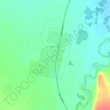
Nombre: Mapa topográfico Beaver Creek, altitud, relieve.
Lugar: Beaver Creek, Yukon, Canada (62.37597 -140.89129 62.38767 -140.86934)
Altitud media: 662 m
Altitud mínima: 646 m
Altitud máxima: 703 m
Haz una donación