
Mapa topográfico Osterode
Haga clic en el mapa para ver la altitud.
Acerca de este mapa
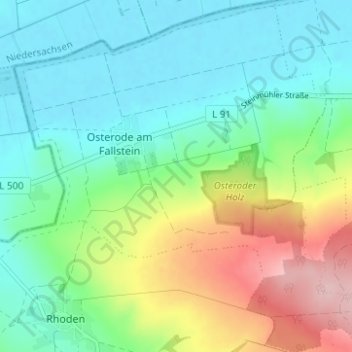
Nombre: Mapa topográfico Osterode, altitud, relieve.
Lugar: Osterode, Osterwieck, Landkreis Harz, Saxony-Anhalt, Germany (52.01062 10.64797 52.04883 10.71011)
Altitud media: 141 m
Altitud mínima: 83 m
Altitud máxima: 278 m
Otros mapas topográficos
Haga clic en un mapa para ver su topografía, su altitud y su relieve.