
Gracias por apoyar a este sitio ❤️
Haz una donación
Haz una donación
Mapa topográfico Velloor
Haga clic en el mapa para ver la altitud.
Gracias por apoyar a este sitio ❤️
Haz una donación
Haz una donación
Acerca de este mapa
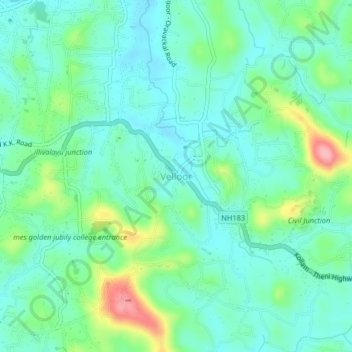
Nombre: Mapa topográfico Velloor, altitud, relieve.
Lugar: Velloor, Kottayam, Kottayam District, Kerala, 686501, India (9.56272 76.58814 9.60272 76.62814)
Altitud media: 38 m
Altitud mínima: 5 m
Altitud máxima: 135 m
Gracias por apoyar a este sitio ❤️
Haz una donación
Haz una donación
Otros mapas topográficos
Haga clic en un mapa para ver su topografía, su altitud y su relieve.
Gracias por apoyar a este sitio ❤️
Haz una donación
Haz una donación
Gracias por apoyar a este sitio ❤️
Haz una donación
Haz una donación