
Mapa topográfico Cochranville
Mapa interactivo
Haga clic en el mapa para ver la altitud.
Acerca de este mapa
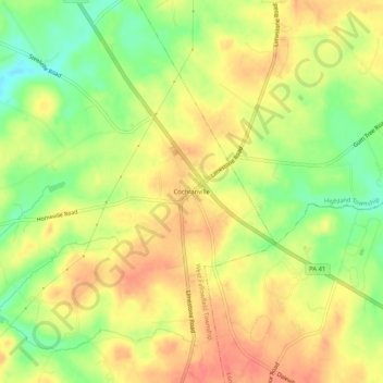
Nombre: Mapa topográfico Cochranville, altitud, relieve.
Altitud media: 170 m
Altitud mínima: 133 m
Altitud máxima: 199 m
Otros mapas topográficos
Haga clic en un mapa para ver su topografía, su altitud y su relieve.
Steelville
United States > Pennsylvania > Chester County > West Fallowfield Township
Steelville, West Fallowfield Township, Chester County, Pennsylvania, 17509, United States
Altitud media: 164 m