
Mapa topográfico Murray
Mapa interactivo
Haga clic en el mapa para ver la altitud.
Acerca de este mapa
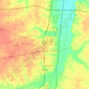
Nombre: Mapa topográfico Murray, altitud, relieve.
Lugar: Murray, Calloway County, Kentucky, United States (36.57182 -88.36125 36.66204 -88.28567)
Altitud media: 159 m
Altitud mínima: 131 m
Altitud máxima: 178 m
Otros mapas topográficos
Haga clic en un mapa para ver su topografía, su altitud y su relieve.
Aboretum
United States > Kentucky > Calloway County > Murray
Aboretum, Murray, Calloway County, Kentucky, United States
Altitud media: 168 m