Mapa topográfico Todey
Mapa interactivo
Haga clic en el mapa para ver la altitud.
Acerca de este mapa
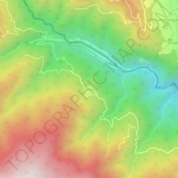
Nombre: Mapa topográfico Todey, altitud, relieve.
Lugar: Todey, Gorubathan, Kalimpong District, West Bengal, India (27.09083 88.80523 27.13083 88.84523)
Altitud media: 1,325 m
Altitud mínima: 756 m
Altitud máxima: 1,969 m
Otros mapas topográficos
Haga clic en un mapa para ver su topografía, su altitud y su relieve.
Rongo
India > West Bengal > Gorubathan
Rongo, Gorubathan, Kalimpong district, West Bengal, India
Altitud media: 1,030 m
Neora Valley National Park
India > West Bengal > Gorubathan > Rongo
Neora Valley National Park, Rongo, Gorubathan, Kalimpong district, West Bengal, India
Altitud media: 1,309 m