
Mapa topográfico Westwood
Mapa interactivo
Haga clic en el mapa para ver la altitud.
Acerca de este mapa
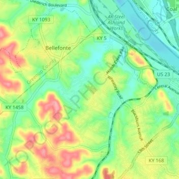
Nombre: Mapa topográfico Westwood, altitud, relieve.
Lugar: Westwood, Fairview, Boyd County, Kentucky, United States (38.45635 -82.70721 38.50581 -82.65651)
Altitud media: 192 m
Altitud mínima: 154 m
Altitud máxima: 252 m
Westwood is a census-designated place in Boyd County, Kentucky, United States. The population was 4,387 at the 2020 census. A suburb of Ashland, the two areas are closely affiliated, sharing a ZIP code and bus system. Westwood is located on a flat to hilly elevation just west of the Ohio River. The flat hilltop is unusual to eastern Kentucky and was created by the preglacial Teays River which existed in ancient times and flowed in the opposite direction of the Ohio River. Westwood is part of the Huntington–Ashland metropolitan area.