
Mapa topográfico McKenzie River
Mapa interactivo
Haga clic en el mapa para ver la altitud.
Acerca de este mapa
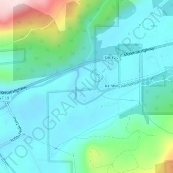
Nombre: Mapa topográfico McKenzie River, altitud, relieve.
Altitud media: 431 m
Altitud mínima: 352 m
Altitud máxima: 739 m
The McKenzie River drains a region of about 1,300 square miles (3,400 km2) and is one of the primary tributaries of the Willamette River. Elevations in the watershed range from 10,358 feet (3,157 m) at the summit of the South Sister to 375 feet (114 m) at the McKenzie's mouth on the Willamette River north of Eugene. The upper basin, in the high Cascades, consists of granular, permeable igneous rocks that are geologically young, while most of the middle and lower McKenzie valley in the Western Cascades is made of the remnants of older, more weathered volcanic rocks. Major watersheds bordering the McKenzie basin include the Calapooia; the South, Middle and North Santiam rivers to the north; the Middle Fork Willamette River to the south; and the Deschutes River to the east.