
Mapa topográfico Berghe Inférieur
Mapa interactivo
Haga clic en el mapa para ver la altitud.
Acerca de este mapa
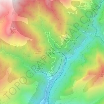
Nombre: Mapa topográfico Berghe Inférieur, altitud, relieve.
Altitud media: 963 m
Altitud mínima: 421 m
Altitud máxima: 1,673 m
Otros mapas topográficos
Haga clic en un mapa para ver su topografía, su altitud y su relieve.
Berghe Supérieur
France > Provence-Alpes-Côte d'Azur > Alpes-Maritimes > Fontan
Berghe Supérieur, Fontan, Nice, Alpes-Maritimes, Provence-Alpes-Côte d'Azur, France métropolitaine, 06540, France
Altitud media: 975 m
Les Celles
France > Provence-Alpes-Côte d'Azur > Alpes-Maritimes > Fontan
Les Celles, Fontan, Nice, Alpes-Maritimes, Provence-Alpes-Côte d'Azur, France métropolitaine, 06540, France
Altitud media: 1,580 m