
Mapa topográfico Drumheller
Mapa interactivo
Haga clic en el mapa para ver la altitud.
Acerca de este mapa
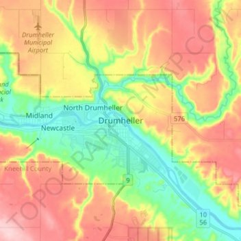
Nombre: Mapa topográfico Drumheller, altitud, relieve.
Lugar: Drumheller, Town of Drumheller, Alberta, T0J 0Y0, Kanada (51.42628 -112.74466 51.50628 -112.66466)
Altitud media: 763 m
Altitud mínima: 675 m
Altitud máxima: 858 m