
Gracias por apoyar a este sitio ❤️
Haz una donación
Haz una donación
Mapa topográfico Porac
Haga clic en el mapa para ver la altitud.
Gracias por apoyar a este sitio ❤️
Haz una donación
Haz una donación
Acerca de este mapa
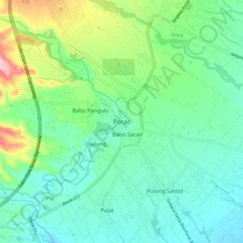
Nombre: Mapa topográfico Porac, altitud, relieve.
Lugar: Porac, Pampanga, Central Luzon, 2008, Philippines (15.03265 120.50302 15.11265 120.58302)
Altitud media: 91 m
Altitud mínima: 34 m
Altitud máxima: 256 m
Gracias por apoyar a este sitio ❤️
Haz una donación
Haz una donación
Otros mapas topográficos
Haga clic en un mapa para ver su topografía, su altitud y su relieve.
Guagua
The climate and topographical features of the vast land of Guagua make it ideal for the growing of fruit trees and vegetables. Among the fruit trees most fitting to be planted are mangoes, guavas, santol, star apples, and bananas. For vegetables, sitao, upo, ampalaya, gabi and cucumber are the most commonly…
Altitud media: 9 m
Gracias por apoyar a este sitio ❤️
Haz una donación
Haz una donación