
Mapa topográfico Neuenahr
Mapa interactivo
Haga clic en el mapa para ver la altitud.
Acerca de este mapa
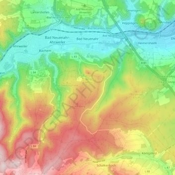
Nombre: Mapa topográfico Neuenahr, altitud, relieve.
Altitud media: 242 m
Altitud mínima: 75 m
Altitud máxima: 472 m
Otros mapas topográficos
Haga clic en un mapa para ver su topografía, su altitud y su relieve.
Ehlingen
Duitsland > Rijnland-Palts > Landkreis Ahrweiler > Bad Neuenahr-Ahrweiler
Ehlingen, Heimersheim, Bad Neuenahr-Ahrweiler, Landkreis Ahrweiler, Rijnland-Palts, Duitsland
Altitud media: 136 m