
Mapa topográfico Gundagai
Mapa interactivo
Haga clic en el mapa para ver la altitud.
Acerca de este mapa
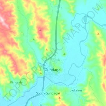
Nombre: Mapa topográfico Gundagai, altitud, relieve.
Altitud media: 309 m
Altitud mínima: 208 m
Altitud máxima: 622 m
Gundagai is an inland town with an elevation of 250 metres (820 ft). Almost all of the shire is located in the South West Slopes bio-region and is part of the Riverina agricultural region. The eastern part of the shire is considered part of the South Eastern Highlands bioregion.