
Mapa topográfico Kennicott
Mapa interactivo
Haga clic en el mapa para ver la altitud.
Acerca de este mapa
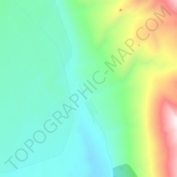
Nombre: Mapa topográfico Kennicott, altitud, relieve.
Lugar: Kennicott, Copper River, Alaska, United States (61.46629 -142.90640 61.50629 -142.86640)
Altitud media: 789 m
Altitud mínima: 503 m
Altitud máxima: 1,569 m
Topographic map showing the location of the Erie, Jumbo, Mother Lode, Bonanza and Glacier Mines in relation to Kennecott. Note the aerial tramways and haulage tunnels.
Otros mapas topográficos
Haga clic en un mapa para ver su topografía, su altitud y su relieve.
Copper River
United States > Alaska > Copper River
Copper River, Alaska, United States
Altitud media: 1,332 m
Middle Hanagita Lake
United States > Alaska > Copper River
Middle Hanagita Lake, Copper River, Alaska, United States
Altitud media: 892 m
Kennecott River
United States > Alaska > Copper River
Kennecott River, Copper River, Alaska, United States
Altitud media: 622 m
Glennallen
United States > Alaska > Copper River
Glennallen, Copper River, Alaska, United States
Altitud media: 581 m
McCarthy
United States > Alaska > Copper River
McCarthy, Copper River, Alaska, United States
Altitud media: 960 m