
Mapa topográfico Gigha
Haga clic en el mapa para ver la altitud.
Gigha
Gigha lies 5 kilometres (3 mi) off the coast of Kintyre and is 9.5 km (6 mi) long in a roughly north-south direction and a maximum of 2.5 km (1 1⁄2 mi) wide. The total area is 1,395 hectares (3,450 acres) and the highest elevation of Creag Bhàn reaches only 100 m (330 ft). The rocky central spine is composed of epidiorite with basalt intrusions.
Acerca de este mapa
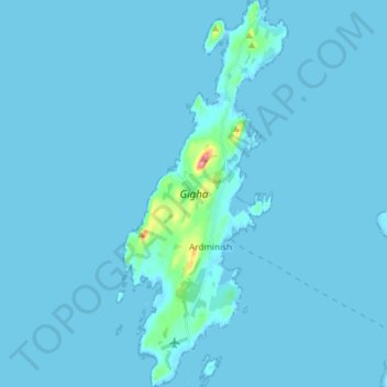
Nombre: Mapa topográfico Gigha, altitud, relieve.
Lugar: Gigha, Ardminish, Argyll and Bute, Scotland, United Kingdom (55.64568 -5.77448 55.72971 -5.71157)
Altitud media: 3 m
Altitud mínima: -4 m
Altitud máxima: 94 m